Today when I catch up with the girls, Natalie is curled up under a desert willow. She’s as far under the willow and in as much of the little shade it provides as she can get. She shades the rest of herself with her umbrella. She is surly, “Leave me alone. I want to die.” Well, that doesn’t sound so good.
Blaze is in the shade next to her. She looks at me, shrugs her shoulders, and diagnoses, “Natalie is grumpy.”
I drop my pack, get out some food and water, and get myself into what shade I can find. Between chewing and slurping, I ask Natalie, “Do you have water? Have you been drinking it? How much? What and how much have you eaten?” She growls out answers. And another, “Leave me alone.” That’s not going to happen. I diagnose grumpiness caused by heat exhaustion. I encourage her to drink water and eat some salty snacks. We still have five more miles to walk today before getting to Ziggy and the Bear’s Whitewater Trail House. She drinks some water and eats a little between snarls. My zipper thermometer says it’s 100 degrees Farenheit in the shade.
Later, Natalie names the stretch of trail (an asphalt then dirt road walk) between the water faucet at the base of Fuller Ridge to Ziggy and the Bear’s place. She calls it, “The Valley of Hell.”
All the Way Down Fuller Ridge
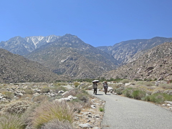
As we break camp that morning, pods of hikers pass us. They are heading up Fuller Ridge to the peak of Mount San Jacinto. Then they are taking the tram down to Palm Springs. I count about 25 of them. They’ve got a long, hot day ahead of them.
We pretty much have one liter of water each to get us the eight miles to the next water source. It’s going to be a thirsty walk.
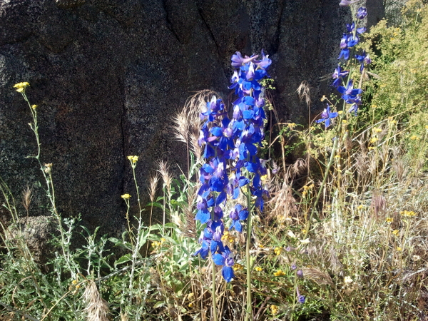
I stop to take a picture of some fountaingrass by some boulders and a cliff. Then I see them. Bees. My umbrella is out. I’ve been using it for shade as I walk. I point it towards the bees, duck under it and run. These bees are very unfriendly. They follow for quite awhile. No stings though. The girls aren’t stung either. Natalie says she ran past declaring loudly, “I’m not a flower. I’m not a flower.” Whatever works.
Two Mile Switchbacks
The trail cuts back into a draw. Shade. I hear a trickle of water. There’s a spring fed pool and a damp creek bed. The water is full of algae and frogs. Guess I’ll leave this one for the critters. Doesn’t look very palatable and probably not much that the critters can spare. There’s a good water source in a few more miles.
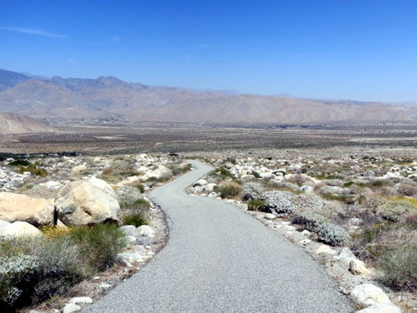
We can see the floor of Snow Creek Canyon below and the promise of water. Then the trail turns west and not just for meandering to the west then east in switchbacks to eventually get us north and down the rest of the ridge. The trail goes west away from water for two miles. Finally, the trail turns east and we find a bit of shade below some rocks and share the last of everyone’s water. Hot, dry, and dusty we walk the last two miles to water.
Back in the Desert
Eventually the trail deposits us on the canyon floor right next to a water faucet. The faucet is provided for hikers courtesy of the Desert Water Agency, which is the local Palm Springs water utility. The faucet appears to be plumbed into the pipeline from their Snow Creek diversion.
I take my turn filling up my water bottle. My mind says fill it up all the way then drink the whole thing but my hand has other ideas. Barely half full and the hand puts the water to my mouth. I drink. Sweet, cold water. Body over mind. Then I refill the water bottle and this time all the way full before drinking.
The water faucet is next to a large boulder that is casting a couple feet of shade at its base. The three of us crawl part way under an overhang of the boulder and into the shade. We expand the shade with our umbrellas and rest.
Another hiker comes off the ridge. He sets up in shade under his own umbrella. The water system security guard asks everyone about the bees. He says they’re Africanized bees, aggressive, and sting most hikers. Another hiker comes in. He asks if there’s room for his head in our shade. We make room. We don’t want anyone to cook their brains in this heat.
Our shade diminishes as the sun climbs higher into the sky. Five more miles to hike today. We walk on.
Under the Highway
The trail is asphalt road for a little over a mile. I don’t like walking on roads. Where the trail leaves the road is the little Snow Creek housing development. A sign in front of one of the homes welcomes hikers. But no one is around, so we push on.
This is not chaparral anymore. This is flat out desert. Hot and sandy. I have a pain on the bottom of my foot like something’s jabbing me. Maybe a rock. I take my shoe off but find nothing. Strange. Later the pain shows its true nature. Another blasted blister.
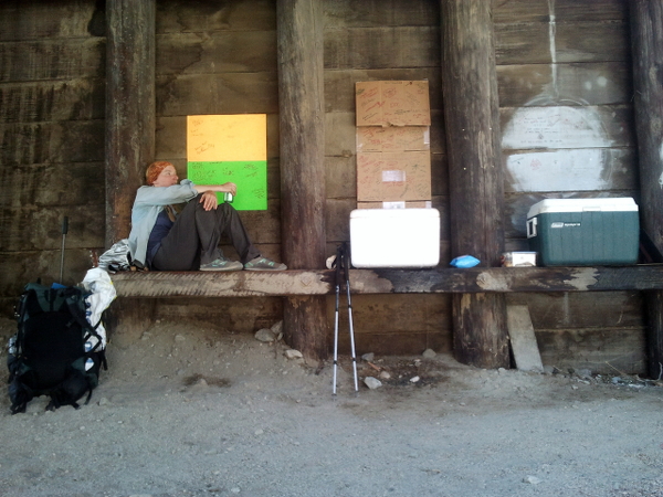
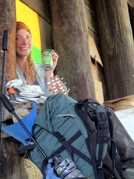
It’s about a mile from Natalie’s “I want to die” desert willow shade to where the trail goes under Interstate 10. I tell her that there will be better shade and it will be cool in the underpass. I’ve heard that hikers often take refuge from the heat there. She’s eventually up to it and we muster on.
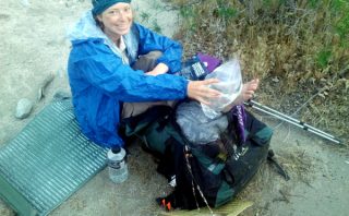
The trail is hard to follow with all the wheeled vehicle tracks criss crossing through here. But one would be hard pressed to get lost since the route parallels I-10. We make it under the highway. We find coolers. Natalie says she is having another happiest day of her life. She is relieved that she’s not going to die after all. We find one beer and some sodas. We each run the cold cans over our foreheads awhile before drinking.
There’s a note and register left by Lake to Lake. Thanks for the trail magic Lake to Lake and others who’ve stocked this cooler. This definitely made a difference to us.
We rest for a long while. I watch the ants. Apparently, there is much to be done in ant world today. The girls nap.
Ziggy and the Bear’s
Just a mile and a half more to the Whitewater Trail House. The gate is welcoming. What a set up for hikers. They (other hikers and volunteers) bring us tubs of hot water for soaking our feet. And a white towel. And then some cold watermelon. Feet are soaked. Then face, hands, arms, and legs washed. The towels are no longer white.
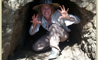
We get the food boxes we shipped here. Hollywood is trying to avoid his trail name. His hiking crew says he never looks trail dirty. But he doesn’t care for the name. I think he’s not going to avoid this one. Natalie avoids being stuck with the name Crawls Under A Bush.
Ziggy and the Bear provide everyone with salad and then ice cream after dinner. There’s wifi and power strips for recharging electronics. There’s a sink for hand washing self and clothes. There are loaner flip flops. They say the’ve just moved here and are only partly set up. Where we are under a tent awning today,they say next year they plan to have a roof, hiker showers, and hiker toilets instead of port-a-potties.
Tomorrow is Mother’s Day. But it’s already tomorrow in Malaysia. We skype Lori and wish her Happy Mother’s Day.
PCT Day 25: 13 miles hiked. Camped at Ziggy and the Bear’s Whitewater Trail House. Section B and 210 miles of the Pacific Crest Trail completed. Click here to read Natalie’s account of the day.